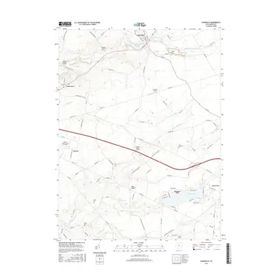
2016 Map of Cedarville
USGS Topo · Published 2016About this map
Cedarville and Wilberforce anchor the northern landscape of this Greene County region, where the winding course of Massies Creek feeds into the Cedarville Reservoir. The area is defined by a dense network of country roads and family-named routes like Tarbox Cemetery Rd and Charlton Mill Rd, reflecting a long history of rural settlement and local industry. To the south, the development of Shawnee Hills around Shawnee Lake provides a contrast to the agricultural surroundings near Monroe and New Jasper.
Find a feature on this map
99 named features on this map. Tap any name to fly to it.
Don’t see what you’re looking for? This feature index may not catch every label — zoom into the map to look around manually.
Map Details
Editions of this 2016 Cedarville Map
This is the sole edition of this map. No revisions or reprints were ever made.
Other maps of this area

1904 · Springfield
USGS Topo · 1:62,500

1906 · Springfield
USGS Topo · 1:62,500

1907 · South Charleston
USGS Topo · 1:62,500

1916 · Octa
USGS Topo · 1:62,500

1917 · Xenia
USGS Topo · 1:62,500

1944 · Octa
USGS Topo · 1:62,500

1947 · Columbus
USGS Topo · 1:250,000

1954 · Clifton
USGS Topo · 1:24,000

1955 · New Burlington
USGS Topo · 1:24,000
1955 · Yellow Springs
USGS Topo · 1:24,000