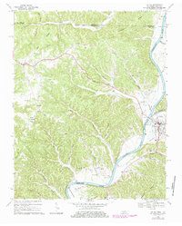
1968 Map of Celina
USGS Topo · Published 1984About this map
Celina stands at the strategic confluence where the Obey River meets the Cumberland River, serving as the primary hub for this portion of Clay Co during the late 1960s. The landscape is defined by the significant presence of the Cordell Hull Reservoir, which transformed the river valley and influenced local infrastructure like the Gaging Sta and Sewage Disposal plant. Higher elevations and ridges above the valley floor are dotted with long-standing rural communities such as Moss, Richville, and Midway.
Find a feature on this map
51 named features on this map. Tap any name to fly to it.
Don’t see what you’re looking for? This feature index may not catch every label — zoom into the map to look around manually.
Map Details
Editions of this 1968 Celina Map
4 editions found

Other maps of this area

1897 · Standingstone
USGS Topo · 1:125,000

1898 · Standingstone
USGS Topo · 1:125,000

1924 · Lillydale
USGS Topo · 1:62,500

1925 · Gainesboro
USGS Topo · 1:62,500

1926 · Lillydale
USGS Topo · 1:62,500

1929 · Lillydale
USGS Topo · 1:62,500

1929 · Gainesboro
USGS Topo · 1:62,500

1929 · Tompkinsville
USGS Topo · 1:62,500

1954 · Blacks Ferry
USGS Topo · 1:24,000

1954 · Tompkinsville
USGS Topo · 1:24,000