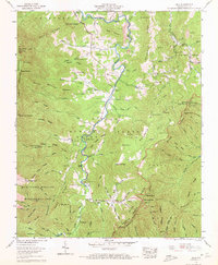
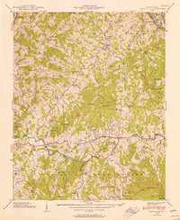
1960 Map of Celo
USGS Topo · Published 1972About this map
The South Toe River valley anchors this mountain landscape, carving a path between the high ridges of Pisgah National Forest and the Mt Mitchell Wildlife Management Area. In 1960, the region’s small mountain communities like Celo and Busick remain centered around rural landmarks such as the South Toe River Sch and Ballew Store. The mapping reveals a dense network of family-named cemeteries and small churches, including Miller Chapel and Hall Chapel, which reflect the generations of settlement in these narrow coves.
Find a feature on this map
126 named features on this map. Tap any name to fly to it.
Don’t see what you’re looking for? This feature index may not catch every label — zoom into the map to look around manually.
Map Details
Editions of this 1960 Celo Map
4 editions found
Other maps of this area

1900 · Mount Mitchell
USGS Topo · 1:125,000

1902 · Mount Mitchell
USGS Topo · 1:125,000

1934 · Micaville
USGS Topo · 1:24,000

1934 · Spruce Pine
USGS Topo · 1:24,000

1934 · Parts Of Celo And Black Brothers
USGS Topo · 1:24,000

1934 · Parts Of Old Fort and Montreat
USGS Topo · 1:24,000

1935 · Montreat
USGS Topo · 1:24,000

1935 · Black Brothers
USGS Topo · 1:24,000

1935 · Burnsville
USGS Topo · 1:24,000
1939 · Burnsville
USGS Topo · 1:24,000