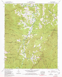
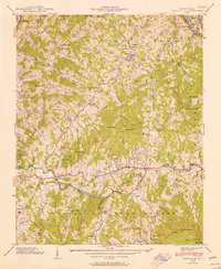
1960 Map of Celo
USGS Topo · Published 1980About this map
The South Toe River carves a deep valley through the heart of this landscape, serving as the primary corridor for mountain settlements like Celo, Estatoe, and Busick. This 1960 field-checked survey reveals a community deeply integrated with its geography, where the South Toe River Sch and gathering spots like Ballew Store anchored local life. Along the river's path, numerous family burial grounds such as the Patton Cem and Grindstaff Cem provide a clear genealogical record of the families who inhabited these slopes. The terrain is dominated by the Pisgah National Forest and the Mt Mitchell Wildlife Management Area, showing a transition toward conservation and recreation at the Carolina Hemlocks Recreation Area. The Blue Ridge Parkway winds across the southeastern ridges, passing through the Twin Tunnels as it skirts the high summits of the Black Mountains.
Find a feature on this map
131 named features on this map. Tap any name to fly to it.
Don’t see what you’re looking for? This feature index may not catch every label — zoom into the map to look around manually.
Map Details
Editions of this 1960 Celo Map
4 editions found
Other maps of this area

1900 · Mount Mitchell
USGS Topo · 1:125,000

1902 · Mount Mitchell
USGS Topo · 1:125,000

1934 · Micaville
USGS Topo · 1:24,000

1934 · Spruce Pine
USGS Topo · 1:24,000

1934 · Parts Of Celo And Black Brothers
USGS Topo · 1:24,000

1934 · Parts Of Old Fort and Montreat
USGS Topo · 1:24,000

1935 · Montreat
USGS Topo · 1:24,000

1935 · Black Brothers
USGS Topo · 1:24,000

1935 · Burnsville
USGS Topo · 1:24,000
1939 · Burnsville
USGS Topo · 1:24,000