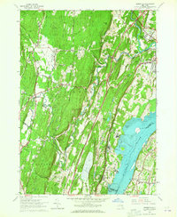
1963 Map of Cementon
USGS Topo · Published 1965About this map
Industrial activity along the western shore of the Hudson River defines this mid-century landscape, where the production of building materials is evidenced by numerous quarries and a gravel pit near Cementon. The era's transportation infrastructure is clearly delineated, showing the New York State Thruway cutting through the terrain while the New York Central Railroad hugs the riverbank, serving riverfront settlements like Smith Landing and Alsen.
Find a feature on this map
54 named features on this map. Tap any name to fly to it.
Don’t see what you’re looking for? This feature index may not catch every label — zoom into the map to look around manually.
Map Details
Editions of this 1963 Cementon Map
4 editions found
Other maps of this area

1892 · Kaaterskill
USGS Topo · 1:62,500

1893 · Kaaterskill
USGS Topo · 1:62,500

1893 · Coxsackie
USGS Topo · 1:62,500

1893 · Durham
USGS Topo · 1:62,500

1894 · Coxsackie
USGS Topo · 1:62,500

1894 · Kaaterskill
USGS Topo · 1:62,500

1894 · Durham
USGS Topo · 1:62,500

1895 · Catskill
USGS Topo · 1:62,500

1899 · Kaaterskill
USGS Topo · 1:62,500

1903 · Kaaterskill
USGS Topo · 1:62,500