
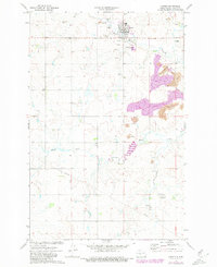
1972 Map of Center
USGS Topo · Published 1974About this map
Center serves as the focal point of this Oliver County landscape, showing the town's layout just north of Square Butte Creek. The surrounding prairie is defined by a distinct transition to industrial resource extraction, with numerous Strip Mines and Scoria Pits carving into the terrain to the north and east. This era of land use is further evidenced by a prominent pipeline cutting across the southern sections of the quadrangle.
Find a feature on this map
17 named features on this map. Tap any name to fly to it.
Don’t see what you’re looking for? This feature index may not catch every label — zoom into the map to look around manually.
Map Details
Editions of this 1972 Center Map
2 editions found
Other maps of this area

1954 · Bismarck
USGS Topo · 1:250,000

1954 · McClusky
USGS Topo · 1:250,000

1958 · Bismarck
USGS Topo · 1:250,000

1958 · McClusky
USGS Topo · 1:250,000

1968 · Hannover NE
USGS Topo · 1:24,000

1968 · Fort Clark
USGS Topo · 1:24,000

1968 · Hannover NW
USGS Topo · 1:24,000

1970 · New Salem NW
USGS Topo · 1:24,000

1970 · New Salem NE
USGS Topo · 1:24,000

1972 · Crown Butte NW
USGS Topo · 1:24,000