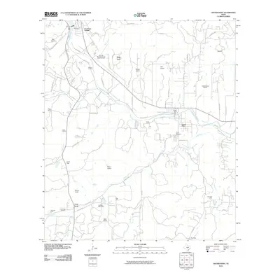
2010 Map of Center Point
USGS Topo · Published 2010About this map
Center Point sits along the Guadalupe River in this 2010 survey of the Texas Hill Country, marked by its distinctive river-bend settlement and proximity to the Center Point Lake Dam. The landscape is a network of named valleys and peaks, including Lookout Mountain and Big Hill, which rise above the surrounding creek drainages. To the south, the historic area around Camp Verde and Old Camp Verde remains a focal point for researchers, home to the Camp Verde Cemetery and situated along Verde Creek. The transition from the rural residential growth near Guadalupe Heights and Shady Grove to the open ranch land of the H-Bar-H Ranch illustrates the region's evolving land use. Aviation history is present at the Kerrville Municipal/Louis Schreiner Field in the northwest, while numerous family-named cemeteries like Wharton Cemetery provide essential markers for local genealogical study.
Find a feature on this map
84 named features on this map. Tap any name to fly to it.
Don’t see what you’re looking for? This feature index may not catch every label — zoom into the map to look around manually.
Map Details
Editions of this 2010 Center Point Map
This is the sole edition of this map. No revisions or reprints were ever made.
Other maps of this area

1894 · Fredericksburg
USGS Topo · 1:125,000

1894 · Kerrville
USGS Topo · 1:125,000

1954 · Llano
USGS Topo · 1:250,000

1954 · San Antonio
USGS Topo · 1:250,000

1955 · Llano
USGS Topo · 1:250,000

1956 · Comfort
USGS Topo · 1:62,500

1956 · Center Point
USGS Topo · 1:62,500

1956 · Llano
USGS Topo · 1:250,000

1957 · San Antonio
USGS Topo · 1:250,000

1964 · Comfort
USGS Topo · 1:24,000