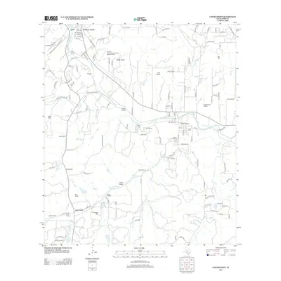
2013 Map of Center Point
USGS Topo · Published 2013About this map
The Guadalupe River carves through this central Texas landscape, anchoring the community of Center Point and its historic Center Point Cem. The map illustrates a transition from the aviation activity at Kerrville Municipal Airport/Louis Schreiner Field in the north to the established ranching and military history of Camp Verde in the south. Numerous hollows and ridges, such as Nowlin Hollow and Lookout Mtn, define the rugged drainage patterns leading into Verde Cr and Elm Cr.
Find a feature on this map
123 named features on this map. Tap any name to fly to it.
Don’t see what you’re looking for? This feature index may not catch every label — zoom into the map to look around manually.
Map Details
Editions of this 2013 Center Point Map
This is the sole edition of this map. No revisions or reprints were ever made.
Other maps of this area

1894 · Fredericksburg
USGS Topo · 1:125,000

1894 · Kerrville
USGS Topo · 1:125,000

1954 · Llano
USGS Topo · 1:250,000

1954 · San Antonio
USGS Topo · 1:250,000

1955 · Llano
USGS Topo · 1:250,000

1956 · Comfort
USGS Topo · 1:62,500

1956 · Center Point
USGS Topo · 1:62,500

1956 · Llano
USGS Topo · 1:250,000

1957 · San Antonio
USGS Topo · 1:250,000

1964 · Comfort
USGS Topo · 1:24,000