
1936 Map of Center Ridge
USGS Topo · Published 1936About this map
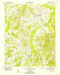
Center Ridge defines the upland terrain of Carroll County in this 1936 aerial-photograph compilation, a period marked by the early engineering works of the Tennessee Valley Authority. The landscape shows a rural economy in transition, where traditional settlements like Poplar Springs Sch and family landmarks such as Sellers Cem and Johnson Cem are connected by the newly designated State Highway No 22. This survey, overseen by Arthur E. Morgan and Carl A. Bock, captures the hydrography of the region prior to further modern development. The presence of the Tennessee Drainage Ditch alongside natural waterways like Roan Creek and Little Bacon Creek reveals a concerted effort to manage the local watershed and reclaim bottomlands for agriculture.
Find a feature on this map
10 named features on this map. Tap any name to fly to it.
Don’t see what you’re looking for? This feature index may not catch every label — zoom into the map to look around manually.
Map Details
Editions of this 1936 Center Ridge Map
This is the sole edition of this map. No revisions or reprints were ever made.
Other maps of this area

1936 · Clarksburg
USGS Topo · 1:24,000

1936 · Yuma
USGS Topo · 1:24,000

1936 · Vale
USGS Topo · 1:24,000

1936 · Buena Vista
USGS Topo · 1:24,000

1950 · Yuma
USGS Topo · 1:24,000

1950 · Palmer Shelter
USGS Topo · 1:24,000

1950 · Vale
USGS Topo · 1:24,000
1950 · Buena Vista
USGS Topo · 1:24,000

1950 · Clarksburg
USGS Topo · 1:24,000

1955 · Huntingdon
USGS Topo · 1:24,000