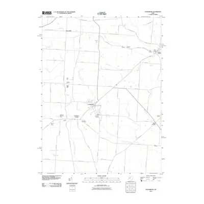
2010 Map of Centerburg
USGS Topo · Published 2010About this map
Centerburg serves as the central hub of this Knox County landscape, where the North Fork Licking River and Otter Fork Licking River converge. The settlement pattern reflects a deeply established rural community, with small clusters like Mount Liberty and Bloomfield punctuating the agricultural grid. Local genealogy is well-documented through numerous burial grounds, including the Kile Cemetery, Linweaver Cemetery, and Centerburg Cemetery, many situated near long-standing crossroads. The area's transition toward recreation is evident in the presence of the Table Rock Golf Course and Wyandot Golf Course, while the terrain is defined by prominent elevations such as Rich Hill. Waterways like Dry Creek and Perfect Creek provide natural drainage across the township, maintaining the traditional landscape even as modern infrastructure like the Centerburg Post Office supports the local population.
Find a feature on this map
77 named features on this map. Tap any name to fly to it.
Don’t see what you’re looking for? This feature index may not catch every label — zoom into the map to look around manually.
Map Details
Editions of this 2010 Centerburg Map
This is the sole edition of this map. No revisions or reprints were ever made.
Other maps of this area

1902 · Westerville
USGS Topo · 1:62,500

1904 · Westerville
USGS Topo · 1:62,500

1908 · Granville
USGS Topo · 1:62,500

1910 · Granville
USGS Topo · 1:62,500

1915 · Marengo
USGS Topo · 1:62,500

1915 · Fredericktown
USGS Topo · 1:62,500

1943 · Marengo
USGS Topo · 1:62,500

1943 · Fredericktown
USGS Topo · 1:62,500

1950 · Marion
USGS Topo · 1:250,000
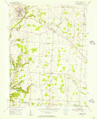
1955 · Sunbury
USGS Topo · 1:24,000