
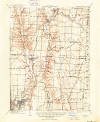
1904 Map of Westerville
USGS Topo · Published 1941About this map
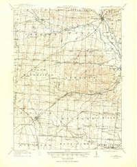
Alum Creek and Big Walnut Creek dominate this central Ohio landscape, their deeply incised valleys cutting through the glacial till of the Scioto River watershed. In the early 20th century, Westerville and Gahanna serve as the primary hubs north of the expanding Columbus city limits. This survey illustrates a complex transportation network where traditional lines like the Pennsylvania R.R. operate alongside the Columbus and Newark Electric R.R., an interurban line that helped facilitate the growth of streetcar suburbs like Linden and East Linden. Smaller settlements like Africa, Central College, and Harlem maintain their identity as rural crossroads, while the northeastern corner shows the headwaters of the Big Walnut Creek system, including Rattlesnake Fork and North Fork. The map documents the intricate township and county boundaries where Franklin, Delaware, and Licking counties meet.
Find a feature on this map
53 named features on this map. Tap any name to fly to it.
Don’t see what you’re looking for? This feature index may not catch every label — zoom into the map to look around manually.
Map Details
Editions of this 1904 Westerville Map
2 editions found
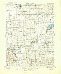
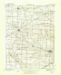
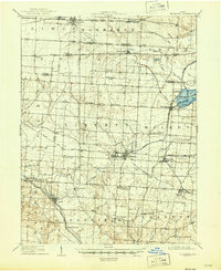
Other maps of this area

1901 · Dublin
USGS Topo · 1:62,500

1902 · Westerville
USGS Topo · 1:62,500

1903 · Dublin
USGS Topo · 1:62,500
1907 · Thurston
USGS Topo · 1:62,500
1908 · Granville
USGS Topo · 1:62,500
1909 · Thurston
USGS Topo · 1:62,500

1910 · Granville
USGS Topo · 1:62,500

1915 · Marengo
USGS Topo · 1:62,500
1915 · Fredericktown
USGS Topo · 1:62,500

1923 · West Columbus
USGS Topo · 1:62,500