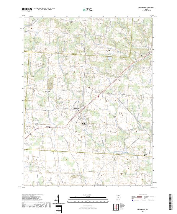
2023 Map of Centerburg
USGS Topo · Published 2023About this map
Centerburg sits at the geographic heart of this Knox County region, where the North Fork Licking River begins its southeasterly course. The landscape is defined by its glacial heritage, with numerous tributary runs like Reynolds Run and Long Run cutting through the agricultural plains. Significant local landmarks include the prominent elevation of Rich Hill and several small rural settlements such as Bloomfield and Mount Liberty. This area serves as a triple-county meeting point, where the borders of Knox, Licking, and Morrow counties converge.
Find a feature on this map
103 named features on this map. Tap any name to fly to it.
Don’t see what you’re looking for? This feature index may not catch every label — zoom into the map to look around manually.
Map Details
Editions of this 2023 Centerburg Map
This is the sole edition of this map. No revisions or reprints were ever made.
Other maps of this area

1902 · Westerville
USGS Topo · 1:62,500

1904 · Westerville
USGS Topo · 1:62,500

1908 · Granville
USGS Topo · 1:62,500

1910 · Granville
USGS Topo · 1:62,500
1915 · Marengo
USGS Topo · 1:62,500
1915 · Fredericktown
USGS Topo · 1:62,500
1943 · Marengo
USGS Topo · 1:62,500
1943 · Fredericktown
USGS Topo · 1:62,500

1950 · Marion
USGS Topo · 1:250,000
1955 · Sunbury
USGS Topo · 1:24,000
Featured Places
- Centerburg, OH
- South Bloomfield Township, OH
- Porter Township, OH
- Bennington Township, OH
- Hilliar Township, OH