
1905 Map of Centerpoint
USGS Topo · Published 1905About this map
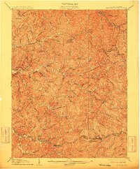
Baltimore and Ohio RR tracks define the southern landscape of this 1905 survey, connecting the bustling village of Salem with nearby Industrial, Bristol, and Sherwood. This corner of West Virginia is a dense network of high ridges and narrow hollows, where life centered around post offices like Alvy P.O. Stringtown and Braden Sta. Lima P.O. while industrial sites like Eagle Mills utilized the region's abundant water power. The map reveals a transition into the West Virginia hills during an era of significant expansion, shown through the convergence of the Tyler and Doddridge County lines. Small rural hubs such as Centerpoint, Big Battle, and Morgansville appear at the intersections of local runs and forks, reflecting the localized river-and-rail economy that sustained these communities before modern infrastructure reshaped the terrain.
Find a feature on this map
124 named features on this map. Tap any name to fly to it.
Don’t see what you’re looking for? This feature index may not catch every label — zoom into the map to look around manually.
Map Details
Editions of this 1905 Centerpoint Map
3 editions found
Other maps of this area

1902 · Clarksburg
USGS Topo · 1:62,500

1903 · Littleton
USGS Topo · 1:62,500

1904 · Weston
USGS Topo · 1:62,500

1904 · Vadis
USGS Topo · 1:62,500

1905 · Mannington
USGS Topo · 1:62,500

1905 · West Union
USGS Topo · 1:62,500

1905 · Littleton
USGS Topo · 1:62,500

1906 · Holbrook
USGS Topo · 1:62,500

1906 · New Martinsville
USGS Topo · 1:62,500

1910 · Clarksburg
USGS Topo · 1:62,500