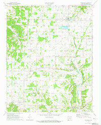
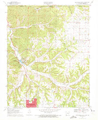
1971 Map of Centerton
USGS Topo · Published 1973About this map
Centerton and the surrounding agricultural landscapes of Benton County appear in the early 1970s, characterized by a dense network of country roads and family-named landmarks. The landscape is defined by the headwaters of Little Osage Creek and Spavinaw Creek, where the local economy and community life revolve around small settlements like Vaughn and Highfill. A notable institutional presence is the Centerton State Fish Hatchery, situated near the town center.
Find a feature on this map
34 named features on this map. Tap any name to fly to it.
Don’t see what you’re looking for? This feature index may not catch every label — zoom into the map to look around manually.
Map Details
Editions of this 1971 Centerton Map
3 editions found
Other maps of this area

1899 · Fayetteville
USGS Topo · 1:125,000

1901 · Fayetteville
USGS Topo · 1:125,000

1904 · Fayetteville
USGS Topo · 1:125,000

1954 · Tulsa
USGS Topo · 1:250,000

1958 · Tulsa
USGS Topo · 1:250,000

1963 · Tulsa
USGS Topo · 1:250,000

1970 · Gallatin
USGS Topo · 1:24,000

1970 · Robinson
USGS Topo · 1:24,000
1970 · Bentonville South
USGS Topo · 1:24,000
1970 · Bentonville North
USGS Topo · 1:24,000