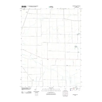
2010 Map of Centerton
USGS Topo · Published 2010About this map
Centerton and Omar anchor this rural landscape in north-central Ohio, showing a highly developed grid of township and section line roads that define the local agricultural character. This 2010 survey by the U.S. Geological Survey reveals a dense distribution of small community cemeteries, which often mark the sites of early family homesteads or vanished church congregations. Omar Cemetery, Centerton Cemetery, and Lutheran Cemetery are primary points of interest for genealogists tracing regional lineages. The hydrology of the area is heavily managed through a network of drainage infrastructure, including Hooper Ditch and Schaaf Ditch, which channel water toward natural courses like Honey Creek and Brokenknife Creek. Evidence of historical industrial transport remains visible at the B & O Railroad Pond, reflecting the legacy of the Baltimore and Ohio line through this corner of Seneca County.
Find a feature on this map
49 named features on this map. Tap any name to fly to it.
Don’t see what you’re looking for? This feature index may not catch every label — zoom into the map to look around manually.
Map Details
Editions of this 2010 Centerton Map
This is the sole edition of this map. No revisions or reprints were ever made.
Other maps of this area

1915 · Norwalk
USGS Topo · 1:62,500

1915 · Siam
USGS Topo · 1:62,500

1915 · Bucyrus
USGS Topo · 1:62,500

1915 · Crestline
USGS Topo · 1:62,500

1943 · Bucyrus
USGS Topo · 1:62,500

1943 · Crestline
USGS Topo · 1:62,500

1944 · Norwalk
USGS Topo · 1:62,500

1950 · Marion
USGS Topo · 1:250,000

1956 · Toledo
USGS Topo · 1:250,000

1960 · Willard
USGS Topo · 1:24,000