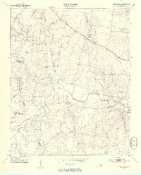
1953 Map of Centertown
USGS Topo · Published 1955About this map
Centertown serves as a central hub in this mid-century landscape where Warren, Cannon, and Coffee counties meet. The area is defined by the winding course of the Barren Fork and its numerous tributaries, such as Bullpen Creek and Willy Creek, which carve through the plateau. A high concentration of family and community burial grounds, including the Old Fellowship Cem, Youngblood Cem, and the Poor House Cem, provides a detailed record of the local population and social history. The rural infrastructure of the early 1950s is evident in the network of country churches like Grange Hall Chapel and Wilson Chapel, alongside small schoolhouses such as Crisp Sch. Along the northern corridor, the N C & St L railroad follows the path of America Broadway, connecting these remote agricultural settlements to the wider Tennessee rail network.
Find a feature on this map
62 named features on this map. Tap any name to fly to it.
Don’t see what you’re looking for? This feature index may not catch every label — zoom into the map to look around manually.
Map Details
Editions of this 1953 Centertown Map
4 editions found

Other maps of this area

1893 · Mc Minnville
USGS Topo · 1:125,000

1895 · Mc Minnville
USGS Topo · 1:125,000

1908 · Woodbury
USGS Topo · 1:62,500

1913 · Hollow Springs
USGS Topo · 1:62,500

1936 · Fredonia
USGS Topo · 1:24,000

1936 · Petty Gap
USGS Topo · 1:24,000

1936 · Morrison
USGS Topo · 1:24,000

1942 · Statesville
USGS Topo · 1:100,000

1943 · Mc Minnville
USGS Topo · 1:100,000

1952 · Centertown
USGS Topo · 1:24,000