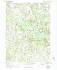
1967 Map of Centerville
USGS Topo · Published 1983About this map
Oil Creek and the Penn Central railroad corridor define the valley floor in this 1960s study of eastern Crawford County. The landscape is characterized by a dense network of namesake crossroads like Drake Corners, Steuben Corners, and Moss Grove Corners, which trace the early settlement patterns of Athens, Rome, and Troy townships. Large tracts of State Game Lands No 122 and State Game Lands No 199 cover the wooded uplands, preserving the rural character of the region.
Find a feature on this map
74 named features on this map. Tap any name to fly to it.
Don’t see what you’re looking for? This feature index may not catch every label — zoom into the map to look around manually.
Map Details
Editions of this 1967 Centerville Map
2 editions found

Other maps of this area

1927 · Townville
USGS Topo · 1:48,000

1927 · Titusville
USGS Topo · 1:62,500

1929 · Corry
USGS Topo · 1:48,000

1929 · Union City
USGS Topo · 1:62,500

1932 · Corry
USGS Topo · 1:62,500

1932 · Townville
USGS Topo · 1:62,500

1932 · Union City
USGS Topo · 1:62,500

1933 · Titusville
USGS Topo · 1:62,500

1945 · Townville
USGS Topo · 1:62,500

1957 · Warren
USGS Topo · 1:250,000