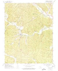
1968 Map of Centerville
USGS Topo · Published 1975About this map
Centerville sits at the confluence of several vital watercourses in the Ozark highlands, where the West Fork Black River meets the Middle Fork Black River to form the main stem of the Black River. This 1968 field-checked survey reveals a landscape defined by steep hollows and ridges, much of which is protected within the Clark National Forest. The settlement pattern follows these narrow valleys, with many landmarks bearing the names of early local families, including Rayfield Cem, Howell Cem, and Johnson Cem.
Find a feature on this map
42 named features on this map. Tap any name to fly to it.
Don’t see what you’re looking for? This feature index may not catch every label — zoom into the map to look around manually.
Map Details
Editions of this 1968 Centerville Map
3 editions found
Other maps of this area

1924 · Edgehill
USGS Topo · 1:62,500

1926 · Edgehill
USGS Topo · 1:62,500

1943 · Lesterville
USGS Topo · 1:62,500

1943 · Boss
USGS Topo · 1:62,500

1944 · Corridon
USGS Topo · 1:62,500

1946 · Lesterville
USGS Topo · 1:62,500

1946 · Boss
USGS Topo · 1:62,500

1947 · Corridon
USGS Topo · 1:62,500

1949 · Rolla
USGS Topo · 1:250,000

1953 · Rolla
USGS Topo · 1:250,000