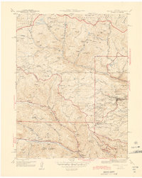
1944 Map of Central City
USGS Topo · Published 1944About this map
The gold mining heart of Gilpin Co and Clear Creek Co is captured here during the mid-1940s, a period when the intense industrial activity of the Front Range had matured into a landscape defined by its deep mining roots. Central City serves as the focal point, surrounded by the high-elevation settlements of Nevadaville, Russell Gulch, and Apex. This survey reveals the intricate network of gulches and peaks that dictated early Colorado development, including the prominent Mt Pisgah and Seaton Mtn.
Find a feature on this map
44 named features on this map. Tap any name to fly to it.
Don’t see what you’re looking for? This feature index may not catch every label — zoom into the map to look around manually.
Map Details
Editions of this 1944 Central City Map
2 editions found

Other maps of this area

1899 · West Denver
USGS Topo · 1:125,000

1903 · Georgetown
USGS Topo · 1:62,500

1905 · Central City
USGS Topo · 1:62,500

1905 · Georgetown
USGS Topo · 1:62,500

1906 · Blackhawk
USGS Topo · 1:62,500

1910 · Central City
USGS Topo · 1:62,500

1912 · Central City
USGS Topo · 1:62,500

1942 · Nederland
USGS Topo · 1:24,000

1942 · Central City
USGS Topo · 1:24,000

1942 · Tungsten
USGS Topo · 1:24,000