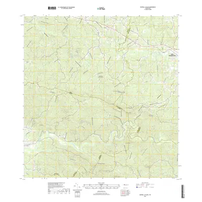
2018 Map of Central La Plata
USGS Topo · Published 2018About this map
Central La Plata and the surrounding highlands of western Puerto Rico are defined by a complex network of canyons and peaks along the municipal borders of San Sebastián, Moca, Añasco, Mayagüez, and Las Marías. This 2018 survey illustrates the varied terrain of the region, where numerous streams like Quebrada El Salto and Quebrada Grande carve through the landscape toward the Island of Puerto Rico interior. The settlement of La Curena sits amidst these prominent summits, which include Cerro Pelao and Cerro Gordo. Modern transportation routes such as PR-111 and PR-109 provide access through these steep elevations. Notable peaks like Cerro Tirano and Cerro Goden anchor the southern portion of the quadrangle, while the northern reaches are crisscrossed by watercourses like Quebrada de las Damas and Quebrada de Loro, reflecting the intricate hydrography that has shaped local agriculture and settlement patterns.
Find a feature on this map
63 named features on this map. Tap any name to fly to it.
Don’t see what you’re looking for? This feature index may not catch every label — zoom into the map to look around manually.
Map Details
Editions of this 2018 Central La Plata Map
This is the sole edition of this map. No revisions or reprints were ever made.
Other maps of this area

1937 · Aguadilla
USGS Topo · 1:20,000

1937 · Moca
USGS Topo · 1:20,000

1938 · Alto Sano
USGS Topo · 1:20,000

1938 · San Sebastian
USGS Topo · 1:20,000

1938 · Quebradillas
USGS Topo · 1:20,000

1939 · Mayaguez
USGS Topo · 1:30,000

1941 · Moca
USGS Topo · 1:30,000

1941 · Rincon
USGS Topo · 1:30,000

1941 · Rincon
USGS Topo · 1:30,000

1941 · San Sebastian
USGS Topo · 1:30,000
Featured Places
- Sector Los Crespos, San Sebastián
- Sector La Grúa, Añasco
- Sector Serrano, San Sebastián
- Sector Bosque, Moca
- Sector Ramírez, Moca