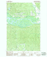
1986 Map of Central Park
USGS Topo · Published 1986About this map
The Chehalis River dominates this mid-1980s landscape, winding through a complex system of tidal waterways and islands just east of Aberdeen. The map reveals the intricate hydrology of the region, where the Wynoochee River joins the main stem amidst a network of side channels like Blue Slough, Mox Chuck Slough, and Preachers Slough. This aquatic labyrinth creates significant landforms such as Sand Island and Higgins I.
Find a feature on this map
31 named features on this map. Tap any name to fly to it.
Don’t see what you’re looking for? This feature index may not catch every label — zoom into the map to look around manually.
Map Details
Editions of this 1986 Central Park Map
2 editions found
Other maps of this area

1940 · Montesano
USGS Topo · 1:62,500

1941 · Mobray
USGS Topo · 1:62,500

1943 · Humptulips
USGS Topo · 1:62,500

1943 · Mobray
USGS Topo · 1:62,500

1953 · Hoquiam
USGS Topo · 1:250,000

1955 · Montesano
USGS Topo · 1:62,500

1955 · Wynoochee Valley
USGS Topo · 1:62,500

1955 · Humptulips
USGS Topo · 1:62,500

1955 · Aberdeen SE
USGS Topo · 1:24,000

1957 · Hoquiam
USGS Topo · 1:250,000