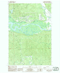
1986 Map of Central Park
USGS Topo · Published 1993About this map
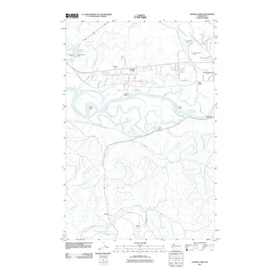
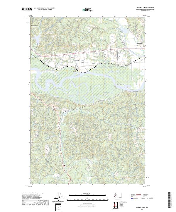
The Chehalis River and Wynoochee River define this Pacific Northwest landscape, creating a complex network of waterways including Blue Slough, Peels Slough, and Mox Chuck Slough. In the mid-1980s, the residential community of Central Park sits between the river bottomlands and the northern hills, characterized by numerous Trailer Parks and local landmarks like the Drive-in Theater and a large Golf Course. To the west, the edge of Aberdeen appears near Lake Aberdeen and its associated Pumping Station. The southern portion of the map transition into the more rural and timbered areas around Artic and Melbourne, where the terrain is dissected by numerous drainages such as Charley Creek, Salmon Creek, and the Little North River. This topographic record highlights the intricate relationship between the region's industrial infrastructure—like Borrow Pits and a Sanitary Disposal Site—and its natural hydrology.
Find a feature on this map
38 named features on this map. Tap any name to fly to it.
Don’t see what you’re looking for? This feature index may not catch every label — zoom into the map to look around manually.
Map Details
Editions of this 1986 Central Park Map
2 editions found
Historical Maps of Aberdeen Through Time
6 maps found