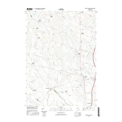
2016 Map of Central Square
USGS Topo · Published 2016About this map
Central Square and the surrounding rural landscape of the northern Oneida River valley are shown in this contemporary topographical view. The map details the transition from the bustling village at the intersection of Watertown Rd and Co Rte 12 to the surrounding hamlets like Caughdenoy, Hastings, and East Palermo. This area is defined by its numerous family-named crossroads, such as Catfish Corners and Roosevelt Corners, and its low-lying hydrology including the Big Bay Swamp and Caughdenoy Creek.
Find a feature on this map
111 named features on this map. Tap any name to fly to it.
Don’t see what you’re looking for? This feature index may not catch every label — zoom into the map to look around manually.
Map Details
Editions of this 2016 Central Square Map
This is the sole edition of this map. No revisions or reprints were ever made.
Other maps of this area

1895 · Syracuse
USGS Topo · 1:62,500

1898 · Syracuse
USGS Topo · 1:62,500

1900 · Baldwinsville
USGS Topo · 1:62,500

1900 · Fulton
USGS Topo · 1:62,500

1905 · Mexico
USGS Topo · 1:62,500

1940 · Brewerton
USGS Topo · 1:24,000

1940 · Cicero
USGS Topo · 1:24,000

1943 · New Haven
USGS Topo · 1:31,680
1943 · Mallory
USGS Topo · 1:31,680

1943 · Brewerton
USGS Topo · 1:31,680