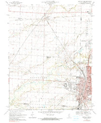
1969 Map of Centralia West
USGS Topo · Published 1990About this map
Industrial and educational growth characterizes the landscape of Marion and Clinton Counties at the end of the 1960s. Centralia serves as the dominant urban hub, its grid-pattern streets housing facilities such as the Murray State Childrens Center, Fairview Park, and numerous neighborhood schools like Schiller Sch and Lincoln Sch. To the west, the emergence of Kaskaskia College represents the era's investment in higher education, while the Shattuc Oil Field and the complex intersection of the Burlington Northern, Baltimore and Ohio, and Southern railroads reveal the region's heavy reliance on transit and natural resources. Along the winding course of Crooked Creek, the map preserves the location of many family and community burial grounds, including Barker Cem and Petrea Cem, which offer significant value for genealogical research into the rural townships of Brookside and Sandoval.
Find a feature on this map
53 named features on this map. Tap any name to fly to it.
Don’t see what you’re looking for? This feature index may not catch every label — zoom into the map to look around manually.
Map Details
Editions of this 1969 Centralia West Map
2 editions found
Other maps of this area

1910 · Carlyle
USGS Topo · 1:62,500

1914 · Centralia
USGS Topo · 1:62,500

1931 · Hoyleton
USGS Topo · 1:48,000

1932 · Nashville
USGS Topo · 1:62,500

1935 · Centralia
USGS Topo · 1:62,500

1936 · Nashville
USGS Topo · 1:62,500

1943 · Ashley
USGS Topo · 1:62,500

1946 · Ashley
USGS Topo · 1:62,500

1948 · Carlyle
USGS Topo · 1:62,500

1958 · Belleville
USGS Topo · 1:250,000