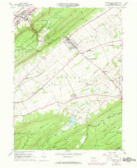
1966 Map of Centre Hall
USGS Topo · Published 1973About this map
Penn Valley serves as the agricultural heart of this region, bracketed by the prominent ridges of Nittany Mountain and Tussey Mountain. In the mid-1960s, the borough of Centre Hall stands as the primary hub, surrounded by smaller rural settlements like Old Fort, Tusseyville, and Potters Mills. The landscape reflects a mix of institutional use and traditional farming, featuring the State Correctional Institution at Rockview alongside the Pennsylvania State University Agronomy Research Farm.
Find a feature on this map
65 named features on this map. Tap any name to fly to it.
Don’t see what you’re looking for? This feature index may not catch every label — zoom into the map to look around manually.
Map Details
Editions of this 1966 Centre Hall Map
3 editions found
Other maps of this area

1908 · Bellefonte
USGS Topo · 1:62,500

1909 · Bellefonte
USGS Topo · 1:62,500

1919 · Menno
USGS Topo · 1:62,500

1924 · Centre Hall
USGS Topo · 1:62,500

1924 · Lewistown
USGS Topo · 1:62,500

1927 · Lewisburg
USGS Topo · 1:62,500

1929 · Centre Hall
USGS Topo · 1:62,500

1935 · Allensville
USGS Topo · 1:62,500

1938 · Allensville
USGS Topo · 1:62,500

1943 · Lewistown
USGS Topo · 1:125,000