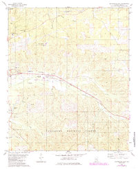
1980 Map of Centreville East
USGS Topo · Published 1985About this map
The Cahaba River winds through the northwestern corner of this territory, where the landscape transitions from the established streets of Centreville into the dense woodlands of the Talladega National Forest. The map documents a community defined by its local landmarks and transportation corridors, including the Illinois Central Gulf railroad line that cuts southeast through Vick and across Sandy Creek. In the upland areas, family history and local heritage are preserved at the Crockett McKinney Cem and the Cahaba Academy, while natural features like Blue Hole and Lightseys Pond suggest the traditional water-oriented recreation of the region.
Find a feature on this map
34 named features on this map. Tap any name to fly to it.
Don’t see what you’re looking for? This feature index may not catch every label — zoom into the map to look around manually.
Map Details
Editions of this 1980 Centreville East Map
2 editions found
Other maps of this area

1890 · Bessemer
USGS Topo · 1:125,000

1891 · Clanton
USGS Topo · 1:125,000

1892 · Bessemer
USGS Topo · 1:125,000

1899 · Brookwood
USGS Topo · 1:125,000

1910 · Montevallo
USGS Topo · 1:62,500

1934 · Blocton
USGS Topo · 1:48,000

1940 · Blocton
USGS Topo · 1:62,500

1953 · Montgomery
USGS Topo · 1:250,000

1953 · Birmingham
USGS Topo · 1:250,000

1956 · Birmingham
USGS Topo · 1:250,000