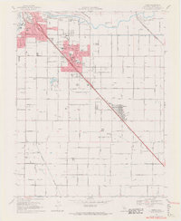
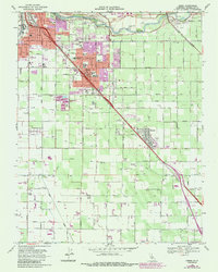
1969 Map of Ceres
USGS Topo · Published 1971About this map
The Tuolumne River defines the northern reaches of this Central Valley landscape, where the growing city of Modesto transitions into the agriculture-focused community of Ceres. This late 1960s survey captures the intricate irrigation network essential to the region's productivity, dominated by a grid of lateral canals such as Upper Lateral No 2 and Lower Lateral No 3. Transportation and industry are centered along the Southern Pacific and Tidewater Southern rail lines, which parallel the diagonal corridor through the town centers.
Find a feature on this map
49 named features on this map. Tap any name to fly to it.
Don’t see what you’re looking for? This feature index may not catch every label — zoom into the map to look around manually.
Map Details
Editions of this 1969 Ceres Map
5 editions found
Other maps of this area

1915 · Westport
USGS Topo · 1:31,680

1915 · Salida
USGS Topo · 1:31,680

1916 · Mitchell School
USGS Topo · 1:31,680

1916 · Crows Landing
USGS Topo · 1:31,680

1916 · Riverbank
USGS Topo · 1:31,680

1916 · Denair
USGS Topo · 1:31,680

1916 · Waterford
USGS Topo · 1:31,680

1916 · Ceres
USGS Topo · 1:31,680

1917 · Turlock
USGS Topo · 1:31,680

1919 · Orestimba
USGS Topo · 1:62,500