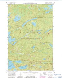
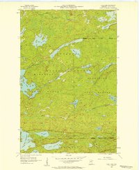
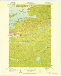
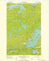
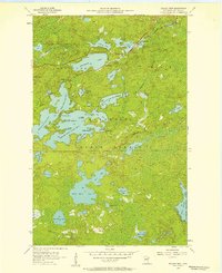
1956 Map of Chad Lake
USGS Topo · Published 1986About this map
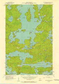
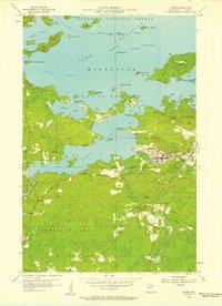
The Indian Sioux River meanders through a dense lacustrine landscape within the Superior National Forest, illustrating the intricate hydrology of the Minnesota Iron Range. This 1956 survey, later updated in 1986, details a remote region where the Boundary Waters Canoe Area Wilderness and the Burnt Side State Forest converge. The cartography reveals a complex network of interconnected waterways, from the large expanse of Chad Lake and Buck Lake to the secluded Adolf Lake and Soroll Lake. At the southern edge of the sheet, the northern reaches of Vermilion Lake appear at Rice Bay and Bass Bay, separated by the prominent Indian Point. These features reflect a landscape almost entirely defined by its glacial heritage, where terrestrial travel is secondary to the extensive system of lakes and creeks like Phantom Creek and Glenmore Creek that once facilitated early regional exploration and timber interests.
Find a feature on this map
37 named features on this map. Tap any name to fly to it.
Don’t see what you’re looking for? This feature index may not catch every label — zoom into the map to look around manually.
Map Details
Editions of this 1956 Chad Lake Map
3 editions found
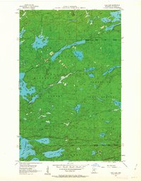
Other maps of this area

1954 · Hibbing
USGS Topo · 1:250,000

1954 · International Falls
USGS Topo · 1:250,000
1956 · Sioux Pine Island
USGS Topo · 1:24,000
1956 · Tower
USGS Topo · 1:24,000
1956 · Chad Lake
USGS Topo · 1:24,000
1956 · Soudan
USGS Topo · 1:24,000
1956 · Crab Lake
USGS Topo · 1:24,000
1956 · Eagles Nest
USGS Topo · 1:24,000

1957 · Hibbing
USGS Topo · 1:250,000

1957 · International Falls
USGS Topo · 1:250,000
Featured Places
- Northeast St Louis, MN
- Crab Lake, MN
- Eagles Nest Township, MN
- Breitung Township, MN
- Saint Louis County, MN