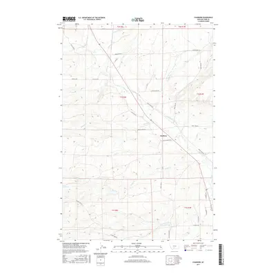
2017 Map of Chadborn
USGS Topo · Published 2017About this map
Shields River flows southeast through the center of this landscape, anchoring a valley defined by agricultural irrigation and rugged basin terrain. The settlement of Chadborn sits at a crossroads where Shields River Rd E meets the tracks of the local transportation corridor. This 2017 survey details the complex water management systems essential to the region, including the Lower Shields Valley Ditch and Palmer Ditch, which trace the contours of the valley floor. To the west, the topography rises sharply toward Bangtail Ridge Rd, with numerous drainages such as Brackett Cr, Bangtail Cr, and Kay Cr feeding into the river system. In the southern reaches, family and landmark-named routes like Crazy Head Rd and Willow Creek Rd provide access to the foothills near Crazy Head Cr and Noel Cr.
Find a feature on this map
41 named features on this map. Tap any name to fly to it.
Don’t see what you’re looking for? This feature index may not catch every label — zoom into the map to look around manually.
Map Details
Editions of this 2017 Chadborn Map
This is the sole edition of this map. No revisions or reprints were ever made.
Other maps of this area

1891 · Livingston
USGS Topo · 1:250,000

1893 · Livingston
USGS Topo · 1:250,000

1947 · Bozeman
USGS Topo · 1:250,000

1948 · Bozeman
USGS Topo · 1:250,000

1951 · Ibex Mountain
USGS Topo · 1:24,000

1951 · Gobblers Knob
USGS Topo · 1:24,000

1951 · Clyde Park
USGS Topo · 1:24,000

1951 · Chadborn
USGS Topo · 1:24,000

1951 · Grannis
USGS Topo · 1:24,000

1951 · Hoppers
USGS Topo · 1:24,000