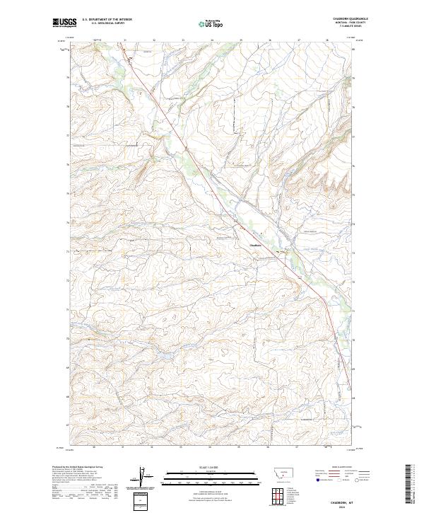
2024 Map of Chadborn
USGS Topo · Published 2024About this map
Chadborn sits at the heart of this Park County landscape, where the Shields River winds through a complex network of agricultural irrigation and mountain drainages. The map details an intricate water management system essential to the region's ranching heritage, featuring the Lower Shields Valley Ditch and Palmer Ditch. To the west, the rising elevations of Bangtail Ridge dominate the horizon, sending numerous seasonal and perennial flows like Canyon Creek and Brackett Creek down toward the valley floor. The southern portion of the quadrangle is defined by the meandering path of Crazy Head Creek and the North Fork Willow Creek, illustrating the transition from high-country ridges to fertile basin land. Numerous family and ranch-named roads, including W Grannis Rd and Mc Niven Rd, provide a modern record of the local geography and land use patterns.
Find a feature on this map
41 named features on this map. Tap any name to fly to it.
Don’t see what you’re looking for? This feature index may not catch every label — zoom into the map to look around manually.
Map Details
Editions of this 2024 Chadborn Map
This is the sole edition of this map. No revisions or reprints were ever made.
Other maps of this area

1891 · Livingston
USGS Topo · 1:250,000

1893 · Livingston
USGS Topo · 1:250,000

1947 · Bozeman
USGS Topo · 1:250,000

1948 · Bozeman
USGS Topo · 1:250,000

1951 · Ibex Mountain
USGS Topo · 1:24,000

1951 · Gobblers Knob
USGS Topo · 1:24,000

1951 · Clyde Park
USGS Topo · 1:24,000

1951 · Chadborn
USGS Topo · 1:24,000

1951 · Grannis
USGS Topo · 1:24,000

1951 · Hoppers
USGS Topo · 1:24,000