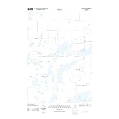
2013 Map of Chain Lake
USGS Topo · Published 2013About this map
The glacial waters of Big Bend and the surrounding Rusk County forests define this 2013 landscape, characterized by an intricate network of kettle lakes and timberland. At the center of the hydrographic system is The Narrows, a passage connecting larger water bodies like Hungry Lake and MacDonald Lake. The area reflects a long-standing tradition of Northwoods recreation and resource management, evidenced by Camp Wahdoon and the Two Bear Camp situated near the northern margin. A significant landmark for forest surveillance, the Stang Lookout Tower stands as a focal point for navigation and fire prevention. The terrain is navigated by a mix of county highways such as Co HWY-D and more localized tracks like Chippewa Trl and Pleasant View Trl, providing access to isolated peninsulas like Deer Head Pt and Sunrise Pt.
Find a feature on this map
108 named features on this map. Tap any name to fly to it.
Don’t see what you’re looking for? This feature index may not catch every label — zoom into the map to look around manually.
Map Details
Editions of this 2013 Chain Lake Map
This is the sole edition of this map. No revisions or reprints were ever made.
Other maps of this area

1948 · Weyerhauser
USGS Topo · 1:48,000

1949 · Bloomer
USGS Topo · 1:62,500

1949 · New Auburn
USGS Topo · 1:62,500

1950 · Weyerhauser
USGS Topo · 1:48,000

1951 · Bloomer
USGS Topo · 1:62,500

1951 · New Auburn
USGS Topo · 1:62,500

1951 · Chetek
USGS Topo · 1:62,500

1953 · Rice Lake
USGS Topo · 1:250,000

1959 · Rice Lake
USGS Topo · 1:250,000
1972 · Fireside Lakes
USGS Topo · 1:24,000