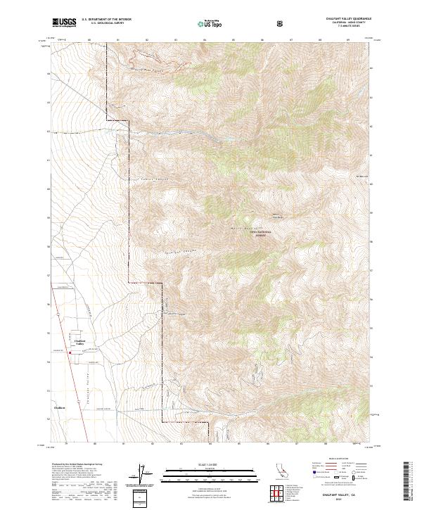
2021 Map of Chalfant Valley
USGS Topo · Published 2021About this map
Chalfant Valley and the small settlement of Chalfant occupy the floor of a broad valley between the White Mountains and the Sierra. This landscape is defined by the transition from the flat agricultural and residential corridor along Valley Rd to the steep eastern slopes of the White-Inyo Range. The map documents a network of named canyons, including Jeffrey Mine Canyon and Sacramento Canyon, which carve into the high country of the Inyo National Forest. Historic mining and transport routes are evident through features like the Slim Princess and Upper Jeffrey Mine Ohv Trl. These tracks follow the natural drainage patterns of Millner Cr and Piute Cr, illustrating how human infrastructure has long adapted to the high-altitude terrain near Mt Barcroft.
Find a feature on this map
28 named features on this map. Tap any name to fly to it.
Don’t see what you’re looking for? This feature index may not catch every label — zoom into the map to look around manually.
Map Details
Editions of this 2021 Chalfant Valley Map
This is the sole edition of this map. No revisions or reprints were ever made.
Other maps of this area

1913 · Bishop
USGS Topo · 1:125,000

1917 · White Mountain
USGS Topo · 1:125,000

1947 · Mariposa
USGS Topo · 1:250,000

1948 · Mariposa
USGS Topo · 1:250,000

1949 · Bishop
USGS Topo · 1:62,500

1951 · Bishop
USGS Topo · 1:62,500

1951 · Blanco Mountain
USGS Topo · 1:62,500

1957 · Mariposa
USGS Topo · 1:250,000

1962 · Mt. Barcroft
USGS Topo · 1:62,500

1962 · White Mtn. Peak
USGS Topo · 1:62,500