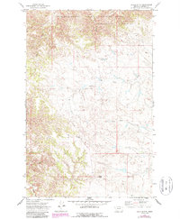
1971 Map of Chalk Butte
USGS Topo · Published 1987About this map
Charles M Russell National Wildlife Refuge dominates the northern reaches of this Garfield County landscape, where the broken plains meet the drainage systems of the Missouri River breaks. The topography is defined by the sharp incisions of Billy Coulee and Black Coulee, which carve through the high ground towards the Snow Creek basin. These seasonal watercourses and the presence of a lone Well underscore the arid conditions and sparse infrastructure of this ranching country in the early 1970s.
Find a feature on this map
7 named features on this map. Tap any name to fly to it.
Don’t see what you’re looking for? This feature index may not catch every label — zoom into the map to look around manually.
Map Details
Editions of this 1971 Chalk Butte Map
2 editions found
Other maps of this area

1954 · Jordan
USGS Topo · 1:250,000

1956 · Jordan
USGS Topo · 1:250,000

1958 · Jordan
USGS Topo · 1:250,000

1964 · Jordan
USGS Topo · 1:250,000

1971 · Hell Hollow
USGS Topo · 1:24,000

1971 · Wolfe Coulee
USGS Topo · 1:24,000

1971 · Wagon Coulee
USGS Topo · 1:24,000

1971 · Sawmill Creek
USGS Topo · 1:24,000

1971 · Chalk Butte
USGS Topo · 1:24,000
1971 · Swede Ridge
USGS Topo · 1:24,000