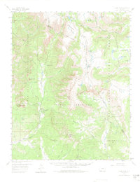
1957 Map of Chama Peak
USGS Topo · Published 1974About this map
Gramps Oil Field sits within the high-elevation terrain of Archuleta County, representing a rare pocket of industrial extraction amidst the expansive San Juan National Forest. The landscape is dominated by the Continental Divide, which separates the headwaters of the Navajo River and the Rio Chama. This mid-century survey documents the area's remote ranching and transit patterns, including the Banded Peak Ranch (Upper Camp) and the Banded Peak Ranch situated near the base of the towering peaks.
Find a feature on this map
46 named features on this map. Tap any name to fly to it.
Don’t see what you’re looking for? This feature index may not catch every label — zoom into the map to look around manually.
Map Details
Editions of this 1957 Chama Peak Map
4 editions found

Other maps of this area

1913 · Summitville
USGS Topo · 1:125,000

1915 · Summitville
USGS Topo · 1:125,000

1918 · Tusas
USGS Topo · 1:125,000

1922 · Conejos
USGS Topo · 1:125,000

1945 · Durango
USGS Topo · 1:250,000

1953 · Durango
USGS Topo · 1:250,000

1954 · Durango
USGS Topo · 1:250,000

1954 · Aztec
USGS Topo · 1:250,000

1955 · Chama
USGS Topo · 1:62,500

1955 · Lumberton
USGS Topo · 1:62,500