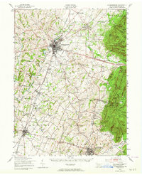
1943 Map of Chambersburg
USGS Topo · Published 1964About this map
Chambersburg serves as the central hub of this 1943 survey, situated at the junction of the Pennsylvania and Western Maryland railroads. The landscape is a dense network of valley settlements and rural institutions, including the prominent Mont Alto Sanatorium and the extensive Letterkenny military reservation to the north. To the east, the terrain rises sharply toward South Mountain, where the State Game Refuge and peaks like Stony Knob overlook the orchard-rich lowlands.
Find a feature on this map
134 named features on this map. Tap any name to fly to it.
Don’t see what you’re looking for? This feature index may not catch every label — zoom into the map to look around manually.
Map Details
Editions of this 1943 Chambersburg Map
3 editions found

Other maps of this area

1900 · Mercersburg
USGS Topo · 1:62,500

1902 · Chambersburg
USGS Topo · 1:62,500

1902 · Mercersburg
USGS Topo · 1:62,500

1909 · Fairfield
USGS Topo · 1:62,500

1909 · Hagerstown
USGS Topo · 1:48,000

1911 · Emmitsburg
USGS Topo · 1:62,500

1912 · Hagerstown
USGS Topo · 1:62,500

1912 · Williamsport
USGS Topo · 1:62,500

1919 · Newville
USGS Topo · 1:62,500

1923 · Shippensburg
USGS Topo · 1:62,500