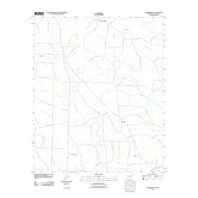
2011 Map of Chambersville
USGS Topo · Published 2011About this map
Chambersville anchors this Arkansas landscape, characterized by a complex network of waterways and timber-related transport. The terrain is defined by the branching paths of Champagnolle Creek and Whitewater Creek, which cut through the Calhoun County interior alongside smaller tributaries like Garden Branch and Little Champagnolle Creek. An interesting industrial artifact is the T and A Tram, a historical logging or transport corridor that cuts diagonally across the grid of county roads.
Find a feature on this map
56 named features on this map. Tap any name to fly to it.
Don’t see what you’re looking for? This feature index may not catch every label — zoom into the map to look around manually.
Map Details
Editions of this 2011 Chambersville Map
This is the sole edition of this map. No revisions or reprints were ever made.
Other maps of this area

1903 · Camden
USGS Topo · 1:125,000

1953 · El Dorado
USGS Topo · 1:250,000

1957 · El Dorado
USGS Topo · 1:250,000

1958 · El Dorado
USGS Topo · 1:250,000

1960 · El Dorado
USGS Topo · 1:250,000

1966 · Kingsland
USGS Topo · 1:24,000

1966 · Fordyce
USGS Topo · 1:24,000

1973 · Bearden
USGS Topo · 1:24,000
1973 · Hampton
USGS Topo · 1:24,000
1973 · Woodberry
USGS Topo · 1:24,000