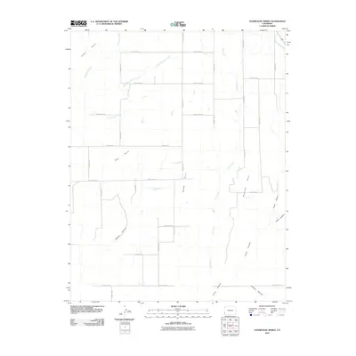
2010 Map of Champagne Spring
USGS Topo · Published 2010About this map
Champagne Spring sits at the heart of this high plateau in southwest Colorado, where the landscape is defined by a series of prominent finger-like ridges and deep-cut drainage systems. Named features like Cedar Point, Bug Point, and McCloud Point reach out over the descending terrain, providing natural landmarks for the grid of county roads that crisscross the territory. The map reveals a complex hydraulic network necessary for this environment, including the Dove Creek Canal in the northeast and seasonal watercourses such as Lower Monument Creek and Dove Creek. As the terrain falls away to the south and east, it carves into dramatic formations including Squaw Canyon, Cross Canyon, and Alkali Canyon, illustrating the transition from flat upland mesas to the deeply eroded canyonlands characteristic of Montezuma County.
Find a feature on this map
28 named features on this map. Tap any name to fly to it.
Don’t see what you’re looking for? This feature index may not catch every label — zoom into the map to look around manually.
Map Details
Editions of this 2010 Champagne Spring Map
This is the sole edition of this map. No revisions or reprints were ever made.
Other maps of this area

1886 · Abajo
USGS Topo · 1:250,000

1892 · Abajo
USGS Topo · 1:250,000

1893 · Abajo
USGS Topo · 1:250,000

1956 · Cortez
USGS Topo · 1:250,000

1957 · Cedar 3 NW
USGS Topo · 1:24,000

1957 · Cedar 3 SW
USGS Topo · 1:24,000

1957 · Monument Canyon
USGS Topo · 1:62,500
1957 · Eastland
USGS Topo · 1:62,500
1958 · Verdure 4 NE
USGS Topo · 1:24,000

1958 · Cortez
USGS Topo · 1:250,000