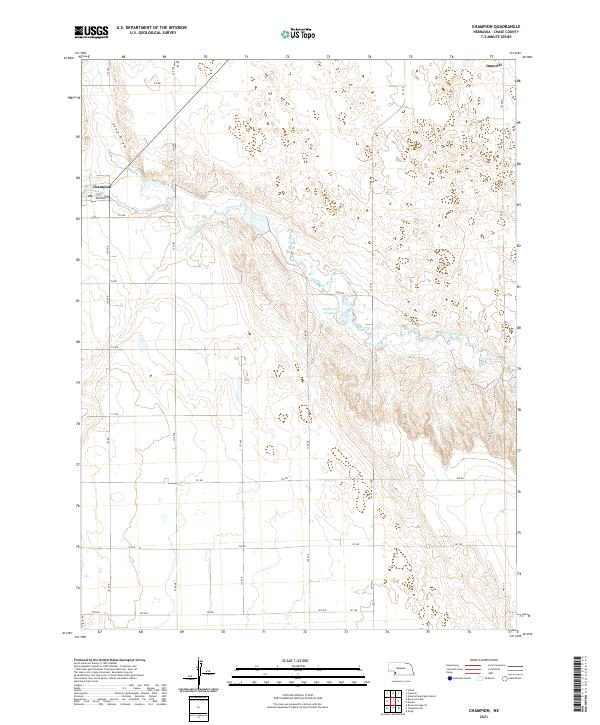
2021 Map of Champion
USGS Topo · Published 2021About this map
Frenchman Creek carves a distinct valley through the high plains of Chase County, shaping the settlement patterns of this agricultural region. The village of Champion is positioned at the western edge of the sheet, where the street grid of Broadway and 2nd St meets the riparian corridor. Further east, the Hoffmeister Reservoir provides a critical water resource in an otherwise arid landscape defined by intermittent drainages like Sand Draw and Foerster Br. A network of rural section-line roads, including 327 Ave and 731 Rd, connects the scattered farmsteads across Townships 5 and 6 North. Near the edge of Imperial, the topography remains largely open, reflecting the transition from the creek bottom to the upland plateaus. This 2021 survey documents the persistent reliance on these watercourses and the orderly grid of the Public Land Survey System that governs the western Nebraska panhandle.
Find a feature on this map
32 named features on this map. Tap any name to fly to it.
Don’t see what you’re looking for? This feature index may not catch every label — zoom into the map to look around manually.
Map Details
Editions of this 2021 Champion Map
This is the sole edition of this map. No revisions or reprints were ever made.
Other maps of this area

1954 · McCook
USGS Topo · 1:250,000

1957 · McCook
USGS Topo · 1:250,000

1958 · McCook
USGS Topo · 1:250,000

1973 · Champion
USGS Topo · 1:24,000
1973 · Chase
USGS Topo · 1:24,000

1973 · Enders
USGS Topo · 1:24,000

1973 · Champion SW
USGS Topo · 1:24,000

1973 · Imperial
USGS Topo · 1:24,000

1973 · Reservoir Lake SE
USGS Topo · 1:24,000

1973 · Ough
USGS Topo · 1:24,000