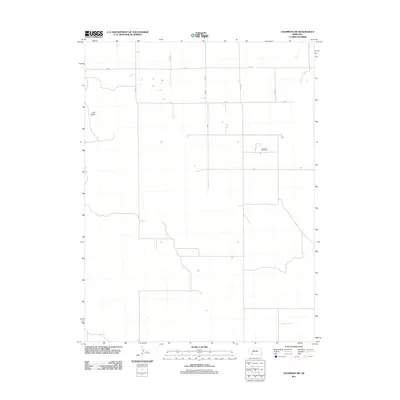
2011 Map of Champion SW
USGS Topo · Published 2011About this map
Hiawatha Cemetery stands as a focal point for genealogy and local heritage in this rural corner of Chase County. The landscape is primarily defined by the rectilinear grid of the Public Land Survey System, with roads like 727 Rd and 330 Ave tracing the section lines across the high plains. The terrain is largely level, though the rise of Old Baldy provides a notable landmark in the western portion of the sheet. This survey illustrates the persistence of the traditional agricultural layout in western Nebraska, where the vast majority of the land is partitioned into square sections for farming and ranching. Small depressions and seasonal hydrographic features are scattered across the landscape, indicating the drainage patterns of the prairie before they reach more significant water bodies outside this immediate quadrangle.
Find a feature on this map
10 named features on this map. Tap any name to fly to it.
Don’t see what you’re looking for? This feature index may not catch every label — zoom into the map to look around manually.
Map Details
Editions of this 2011 Champion SW Map
This is the sole edition of this map. No revisions or reprints were ever made.
Other maps of this area

1954 · McCook
USGS Topo · 1:250,000

1957 · McCook
USGS Topo · 1:250,000

1958 · McCook
USGS Topo · 1:250,000

1973 · Champion
USGS Topo · 1:24,000
1973 · Haigler NE
USGS Topo · 1:24,000

1973 · Enders
USGS Topo · 1:24,000

1973 · Champion SW
USGS Topo · 1:24,000

1973 · Reservoir Lake SE
USGS Topo · 1:24,000

1973 · Ough
USGS Topo · 1:24,000
1973 · Benkelman NW
USGS Topo · 1:24,000