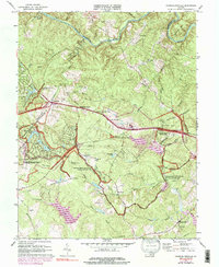
1973 Map of Chancellorsville
USGS Topo · Published 1991About this map
The Frederickburg-Spotsylvania National Military Park dominates this terrain, preserving the complex networks of the 1860s through markers and monuments. This 1973 revision highlights the significant historical imprint on the landscape, where Battle Trenches and commemorative sites like the Jackson Monument and Wadsworth Monument line the modern roadways. The presence of the Old Railroad Grade and the Jackson Furnace ruins indicates the area's earlier industrial and transport foundations, which were later overlaid by the infrastructure of the park and rural settlements such as Wilderness Corner and Cookstown.
Find a feature on this map
68 named features on this map. Tap any name to fly to it.
Don’t see what you’re looking for? This feature index may not catch every label — zoom into the map to look around manually.
Map Details
Editions of this 1973 Chancellorsville Map
3 editions found
Other maps of this area

1887 · Spottsylvania
USGS Topo · 1:125,000

1892 · Spottsylvania
USGS Topo · 1:125,000

1942 · Belmont
USGS Topo · 1:31,680

1942 · Spotsylania
USGS Topo · 1:31,680

1942 · Brokenburg
USGS Topo · 1:31,680

1943 · Germanna Bridge
USGS Topo · 1:24,000

1943 · Chancellorsville
USGS Topo · 1:24,000

1943 · Salem Church
USGS Topo · 1:24,000

1943 · Mine Run
USGS Topo · 1:24,000
1944 · Mine Run
USGS Topo · 1:31,680