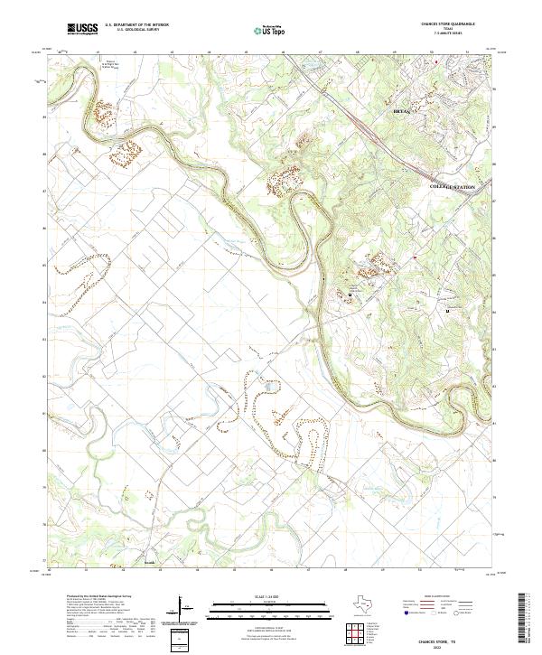
2022 Map of Chances Store
USGS Topo · Published 2022About this map
The Brazos River forms a serpentine border between Burleson and Brazos counties, carving a landscape defined by its shifting hydrology. To the west, the floodplain is marked by remnant channels like Old River and Butler Bayou, where the land is lower and prone to the cycles of the river system. This area near Snook contrasts with the rising elevation to the east, where the outskirts of Bryan and College Station expand toward the river valley.
Find a feature on this map
94 named features on this map. Tap any name to fly to it.
Don’t see what you’re looking for? This feature index may not catch every label — zoom into the map to look around manually.
Map Details
Editions of this 2022 Chances Store Map
This is the sole edition of this map. No revisions or reprints were ever made.
Other maps of this area

1914 · Gay Hill
USGS Topo · 1:62,500

1954 · Austin
USGS Topo · 1:250,000

1956 · Bryan
USGS Topo · 1:62,500

1956 · Caldwell
USGS Topo · 1:62,500

1956 · Somerville
USGS Topo · 1:62,500

1959 · Clay
USGS Topo · 1:24,000

1960 · Lyons
USGS Topo · 1:24,000
1960 · Snook
USGS Topo · 1:24,000

1961 · Mumford
USGS Topo · 1:24,000

1961 · Wellborn
USGS Topo · 1:24,000