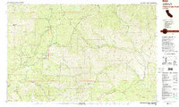
1981 Map of Chanchelulla Peak
USGS Topo · Published 1981About this map
Chanchelulla Peak dominates the high country along the Trinity and Shasta county line, where mining and ranching once defined the remote landscape. This 1981 survey documents the industrial footprints of the Midas Mine, Victory Mine, and Big Cow Mine, along with water management infrastructure like the Swett Ditch. In the valleys, established operations such as Williams Ranch, Graves Ranch, and Sylvester Ranch show the persistent agricultural use of the land alongside protected acreage within the Trinity National Forest.
Find a feature on this map
64 named features on this map. Tap any name to fly to it.
Don’t see what you’re looking for? This feature index may not catch every label — zoom into the map to look around manually.
Map Details
Editions of this 1981 Chanchelulla Peak Map
2 editions found
Other maps of this area

1890 · Red Bluff
USGS Topo · 1:250,000

1894 · Red Bluff
USGS Topo · 1:250,000

1909 · Big Bar
USGS Topo · 1:96,000

1913 · Weaverville
USGS Topo · 1:125,000

1915 · Big Bar and Vicinity
USGS Topo · 1:250,000

1931 · Hoaglin
USGS Topo · 1:96,000

1935 · Hoaglin
USGS Topo · 1:125,000

1944 · French Gulch
USGS Topo · 1:62,500

1948 · French Gulch
USGS Topo · 1:62,500

1950 · Weaverville
USGS Topo · 1:62,500