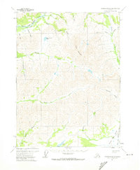
1971 Map of Chandalar B-6
USGS Topo · Published 1974About this map
Middle Fork Koyukuk River and the South Fork Koyukuk River define the landscape of this Arctic interior region during the early 1970s. The map captures a wilderness characterized by seasonal transit corridors, including a Winter Road along the Middle Fork and a Winter Trail navigating the eastern slopes near California Creek. Human activity is sparse, marked primarily by a Landing Strip and isolated Cabin sites, suggesting a reliance on bush aviation and cold-weather overland travel. High-altitude landmarks like Poss Mountain tower over a complex network of drainages such as Minnie Creek and Slate Creek. A solitary Mine near the northern boundary reflects the era's persistent mineral exploration. The presence of Minnie Creek Lake and Winers Lake provides specific points of interest for those tracking local hydrologic features or backcountry routes in this remote portion of the Yukon-Koyukuk region.
Find a feature on this map
30 named features on this map. Tap any name to fly to it.
Don’t see what you’re looking for? This feature index may not catch every label — zoom into the map to look around manually.
Map Details
Editions of this 1971 Chandalar B-6 Map
2 editions found
Other maps of this area

1951 · Chandalar
USGS Topo · 1:250,000

1951 · Wiseman
USGS Topo · 1:250,000

1956 · Chandalar
USGS Topo · 1:250,000

1956 · Wiseman
USGS Topo · 1:250,000

1964 · Wiseman
USGS Topo · 1:250,000

1964 · Chandalar
USGS Topo · 1:250,000

1970 · Wiseman A-1
USGS Topo · 1:63,360
1970 · Chandalar A-6
USGS Topo · 1:63,360
1970 · Chandalar A-5
USGS Topo · 1:63,360

1971 · Chandalar B-5
USGS Topo · 1:63,360