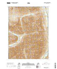
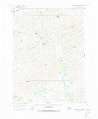
2017 Map of Chandalar C-6 NW
USGS Topo · Published 2017About this map
Gates of the Arctic National Park dominates this subarctic landscape in the northern Yukon-Koyukuk region. The map captures a vital transit corridor where the Alaska Pipeline and the Dalton Highway parallel the Dietrich River in the northeastern corner. This infrastructure represents a thin line of human engineering through an otherwise roadless wilderness defined by complex drainage systems. To the west, the Hammond River carves its path, while the high-elevation Kaaruk Lake sits tucked between steep ridges. In the southeast, the terrain descends toward the Middle Fork Koyukuk River. The transition from river bottomlands to high mountain peaks is evident in the drainage patterns of smaller tributaries like Snowden Cr, which feeds the larger valley networks essential for navigation in this remote interior.
Find a feature on this map
14 named features on this map. Tap any name to fly to it.
Don’t see what you’re looking for? This feature index may not catch every label — zoom into the map to look around manually.
Map Details
Editions of this 2017 Chandalar C-6 NW Map
This is the sole edition of this map. No revisions or reprints were ever made.
Other maps of this area

1951 · Chandalar
USGS Topo · 1:250,000

1951 · Wiseman
USGS Topo · 1:250,000

1956 · Chandalar
USGS Topo · 1:250,000

1956 · Wiseman
USGS Topo · 1:250,000

1964 · Wiseman
USGS Topo · 1:250,000

1964 · Chandalar
USGS Topo · 1:250,000
1971 · Chandalar D-6
USGS Topo · 1:63,360
1971 · Chandalar C-6
USGS Topo · 1:63,360
1971 · Wiseman C-1
USGS Topo · 1:63,360
1971 · Wiseman D-1
USGS Topo · 1:63,360