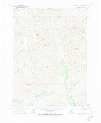
1971 Map of Wiseman D-1
USGS Topo · Published 1974About this map
The Koyukuk River and its major tributaries dominate this high-latitude terrain, illustrating the intricate drainage patterns of the Brooks Range foothills in the early 1970s. The map reveals a landscape defined by sharp elevation changes and significant peaks, such as Alhamblar Mountain and Falsoola Mountain in the north, and Whiteface Mountain to the south. Transport through this roadless wilderness relies on natural corridors like Kinnorutin Pass, which connects the Kinnorutin Creek drainage with Amawk Creek. The convergence of the Hammond River and the Koyukuk River creates a central valley floor, while numerous named creeks like Kovithyukpuk Creek and Eekayruk Creek underscore the importance of water systems in navigating and identifying this vast interior territory.
Find a feature on this map
26 named features on this map. Tap any name to fly to it.
Don’t see what you’re looking for? This feature index may not catch every label — zoom into the map to look around manually.
Map Details
Editions of this 1971 Wiseman D-1 Map
2 editions found
Other maps of this area

1951 · Chandler Lake
USGS Topo · 1:250,000

1951 · Chandalar
USGS Topo · 1:250,000

1951 · Brooks
USGS Topo · 1:250,000

1951 · Wiseman
USGS Topo · 1:250,000

1956 · Chandalar
USGS Topo · 1:250,000

1956 · Wiseman
USGS Topo · 1:250,000

1956 · Philip Smith Mountains
USGS Topo · 1:250,000

1956 · Chandler Lake
USGS Topo · 1:250,000

1964 · Wiseman
USGS Topo · 1:250,000

1964 · Chandalar
USGS Topo · 1:250,000