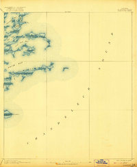
1893 Map of Chandeleur
USGS Topo · Published 1921About this map
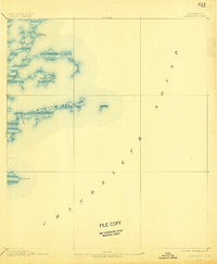
Chandeleur Sound dominates this late-nineteenth-century coastal survey, capturing the ephemeral marshlands and islands of St. Bernard Parish before modern subsidence and storm events reshaped the Louisiana shoreline. The landscape is a labyrinth of salt spray and brackish water, characterized by low-lying features such as Mitchell Key and the isolated Barrel Key. Surveying by the U.S. Coast and Geodetic Survey reveals a complex network of maritime passages like Elephant Point Pass and Keelboat Pass, which were essential for navigating the shallow waters between the gulf and the mainland basins. The cartography highlights a fragile coastal ecology where land and water merge at Live Oak Bayou and Redfish Bend. This document serves as a primary record of the deltaic islands as they existed in the 1890s, offering a baseline for studying coastal erosion and the shifting geography of the eastern Louisiana marshes.
Find a feature on this map
15 named features on this map. Tap any name to fly to it.
Don’t see what you’re looking for? This feature index may not catch every label — zoom into the map to look around manually.
Map Details
Editions of this 1893 Chandeleur Map
3 editions found
Other maps of this area

1893 · Cat Island
USGS Topo · 1:62,500

1893 · La Fortuna
USGS Topo · 1:62,500

1893 · Chandeleur
USGS Topo · 1:62,500

1893 · Toulme
USGS Topo · 1:62,500

1895 · Bodreau
USGS Topo · 1:62,500

1935 · Morgan Harbor
USGS Topo · 1:31,680

1935 · Mitchell Keys
USGS Topo · 1:31,680

1946 · Oak Mound Bayou
USGS Topo · 1:31,680
1949 · Drum Bay
USGS Topo · 1:31,680
1949 · Door Point
USGS Topo · 1:31,680