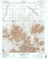
1956 Map of Chandler Heights
USGS Topo · Published 1975About this map
Chandler Heights sits at the edge of the desert valley, where geometric agricultural developments meet the abrupt rising of the Santan Mountains and the Goldmine Mountains. This mid-century survey documents a transition in land use, showing orchards and fields served by the Roosevelt Canal as they press against the borders of the Gila River Indian Reservation. Transportation routes such as the Hunt Highway and the Southern Pacific railroad reflect the region's reliance on commerce and transport between local farms and larger markets. The landscape is punctuated by isolated elevations like Round Top and Rock Peak, while the drainage of Queen Creek defines the northern topography. A Landing Strip and numerous local roads like Santan Boulevard indicate the expansion of local infrastructure during this era of Arizona's growth.
Find a feature on this map
20 named features on this map. Tap any name to fly to it.
Don’t see what you’re looking for? This feature index may not catch every label — zoom into the map to look around manually.
Map Details
Editions of this 1956 Chandler Heights Map
4 editions found
Other maps of this area

1904 · Desert Well
USGS Topo · 1:62,500

1906 · Desert Well
USGS Topo · 1:62,500

1907 · Sacaton
USGS Topo · 1:62,500

1913 · Mesa
USGS Topo · 1:62,500

1914 · Gila Butte
USGS Topo · 1:62,500

1915 · Mesa
USGS Topo · 1:62,500

1917 · Gila Butte
USGS Topo · 1:62,500

1952 · Gila Butte SE
USGS Topo · 1:24,000

1952 · Chandler
USGS Topo · 1:24,000

1952 · Gila Butte
USGS Topo · 1:24,000