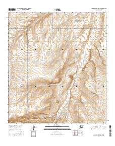
2016 Map of Chandler Lake B-5 NW
USGS Topo · Published 2016About this map
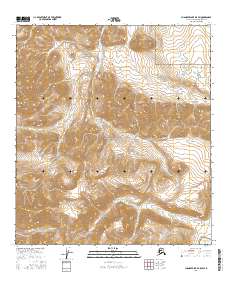
Gates of the Arctic National Park encompasses much of this interior Alaskan wilderness, where the high Arctic landscape is defined by the convergence of several major river systems. The Ayiyak River and Kiruktagiak River flow through the territory, carving paths through the steep terrain. A significant geographical landmark known as The Notch stands as a focal point in the central portion of the sheet, where Notch Cr originates and flows eastward. Smaller tributaries such as Monotis Cr and Aucella Cr drain the high-elevation slopes, illustrating a complex hydrological network. This 2016 survey documents the untouched topography of the North Slope, revealing a landscape where natural boundaries and watercourses remain the primary features of the land, far removed from modern development or infrastructure.
Find a feature on this map
11 named features on this map. Tap any name to fly to it.
Don’t see what you’re looking for? This feature index may not catch every label — zoom into the map to look around manually.
Map Details
Editions of this 2016 Chandler Lake B-5 NW Map
This is the sole edition of this map. No revisions or reprints were ever made.
Other maps of this area

1951 · Chandler Lake
USGS Topo · 1:250,000

1951 · Killik River
USGS Topo · 1:250,000

1956 · Chandler Lake
USGS Topo · 1:250,000

1956 · Killik River
USGS Topo · 1:250,000

1964 · Chandler Lake
USGS Topo · 1:250,000
1986 · Killik River B-1
USGS Topo · 1:63,360
1986 · Killik River C-1
USGS Topo · 1:63,360
1987 · Chandler Lake B-5
USGS Topo · 1:63,360
1987 · Chandler Lake C-5
USGS Topo · 1:63,360
2016 · Chandler Lake B-5 SW
USGS Topo · 1:25,000