
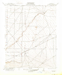
1922 Map of Chaney Ranch
USGS Topo · Published 1922About this map
Panoche Creek winds through this arid expanse of western Fresno County, providing a critical hydrological marker in a landscape defined by its topographic undulations. In this early twentieth-century survey, the isolated Chaney Ranch stands as a primary point of human settlement, situated at the intersection of early secondary routes and range lines. The map's high-detail contour work by Kiger and Fankhauser reveals the intricate drainage patterns feeding into the creek bed, illustrating the natural terrain that local ranchers navigated before more intensive irrigation reshaped the region. This document captures the transition between the open range and more formalized land divisions during the Stephens administration, providing an essential look at the geography of the Panoche valley prior to modern agricultural developments.
Find a feature on this map
4 named features on this map. Tap any name to fly to it.
Don’t see what you’re looking for? This feature index may not catch every label — zoom into the map to look around manually.
Map Details
Editions of this 1922 Chaney Ranch Map
2 editions found
Other maps of this area

1913 · Panoche
USGS Topo · 1:125,000

1921 · Tierra Loma School
USGS Topo · 1:31,680

1922 · Tufts Ranch
USGS Topo · 1:31,680

1923 · Levis
USGS Topo · 1:31,680

1923 · Wisdom Well
USGS Topo · 1:31,680

1923 · Firebaugh
USGS Topo · 1:31,680

1923 · Tierra Loma School
USGS Topo · 1:31,680

1923 · Little Panoche
USGS Topo · 1:31,680

1923 · Monocline Ridge
USGS Topo · 1:31,680
1941 · Firebaugh
USGS Topo · 1:31,680