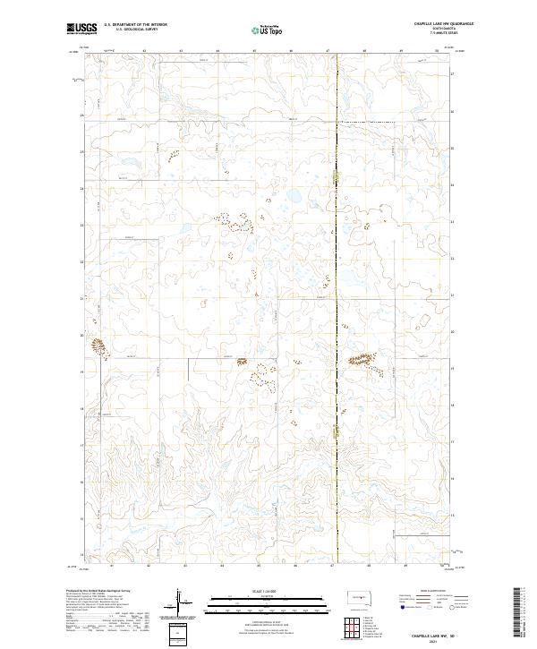
2021 Map of Chapelle Lake NW
USGS Topo · Published 2021About this map
Chapelle Cr meanders across the southern landscape of this central South Dakota region, defining the drainage patterns through these rural townships. The map documents the boundary line where Hughes Co and Hyde Co meet, a divide marked by a section-line road that splits the high prairie terrain. This 2021 survey illustrates a highly organized grid of early-settlement section lines, including 200th St and 324th Ave, which continue to dictate the movement of people and livestock across the plains. The concentration of wetlands and small basins scattered across the northern sections highlights the glacial topography of the area, providing a precise look at the hydrology as it existed during this modern period of land management.
Find a feature on this map
19 named features on this map. Tap any name to fly to it.
Don’t see what you’re looking for? This feature index may not catch every label — zoom into the map to look around manually.
Map Details
Editions of this 2021 Chapelle Lake NW Map
This is the sole edition of this map. No revisions or reprints were ever made.
Other maps of this area

1953 · Huron
USGS Topo · 1:250,000

1954 · Huron
USGS Topo · 1:250,000

1967 · Blunt SE
USGS Topo · 1:24,000

1967 · De Grey NE
USGS Topo · 1:24,000

1968 · Harrold
USGS Topo · 1:24,000

1968 · Holabird
USGS Topo · 1:24,000

1973 · Chapelle Lake SE
USGS Topo · 1:24,000

1973 · De Grey SE
USGS Topo · 1:24,000

1973 · Chapelle Lake SW
USGS Topo · 1:24,000

1973 · Chapelle Lake
USGS Topo · 1:24,000